In May 2021 Panha Suon drew a design for a small triangle of land, which we called A-land. The idea was a family-size homestead: a small earthbag house, a market garden, and the forest close by. He drew it the permaculture way, one map at a time.
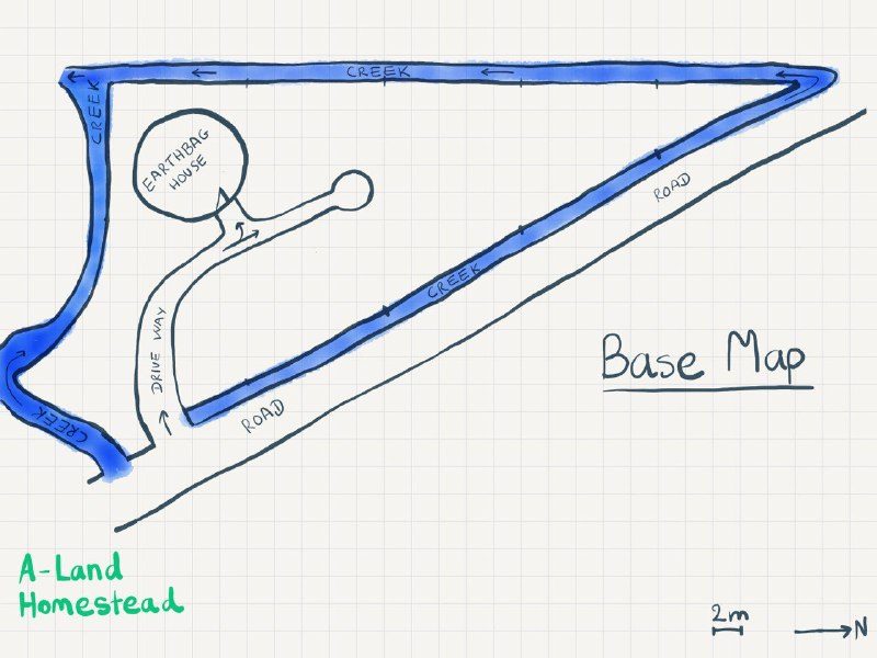
The base map
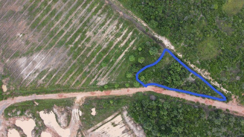
First, trace the plot from an aerial photo: the outline, the creeks, the road, the house, and anything that should not move, like big rocks and big trees. Mark north and a rough scale. It does not need to be exact.
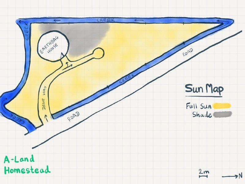
Sun
Watch where the sun falls through the day. In Cambodia the sun's path changes little over the year. Anything with at least six hours of sun is full sun. The rest is shade under trees.
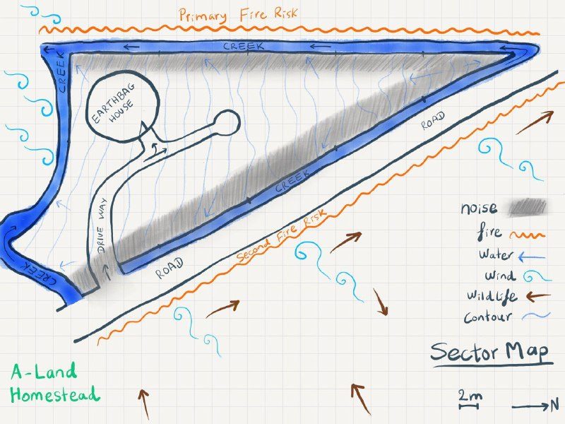
What comes in from outside
The sector map shows what passes through the land: noise from the roads, wind from the northeast in the dry season and from the southwest in the wet season, animals coming from the forest across the road, and rain running off into the creeks. It also shows where fire is likely to come from. On one side the neighbouring land is young forest that often burns, and that is out of our hands.
The plan
Hardwood and fruit trees along the edges, to hold the soil against the creeks. Some of the switch cane left standing as a fence and a trellis for climbing vegetables. Low, deep-rooted bushes at the front so morning sun still reaches the beds. Vegetable beds facing east. A rain tank by the roof, a dry toilet, an outdoor kitchen, a seedling nursery, compost and a small pond. At the narrow tip, a small forest garden, to see whether shade can push back the switch cane.
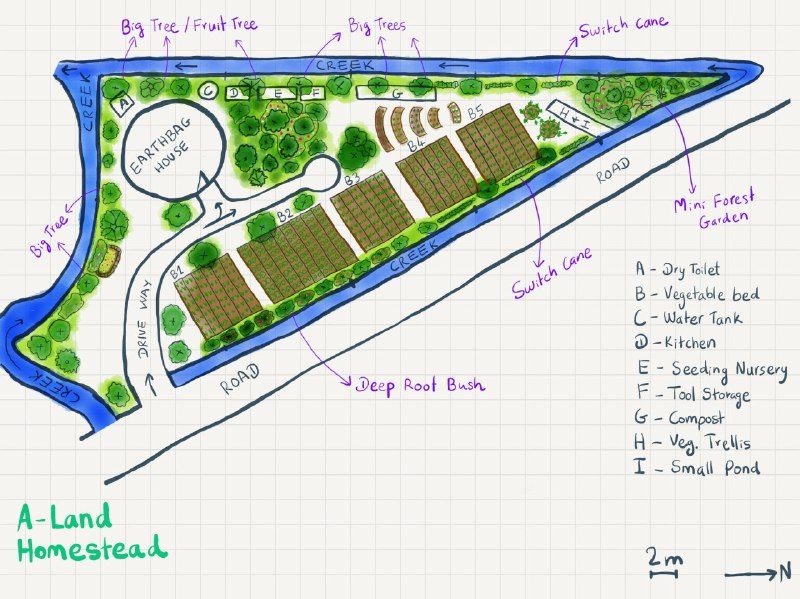
Panha Suon's posts were first published on our Telegram channel: A-land, zone map, base map, sun map, sector map, master map.